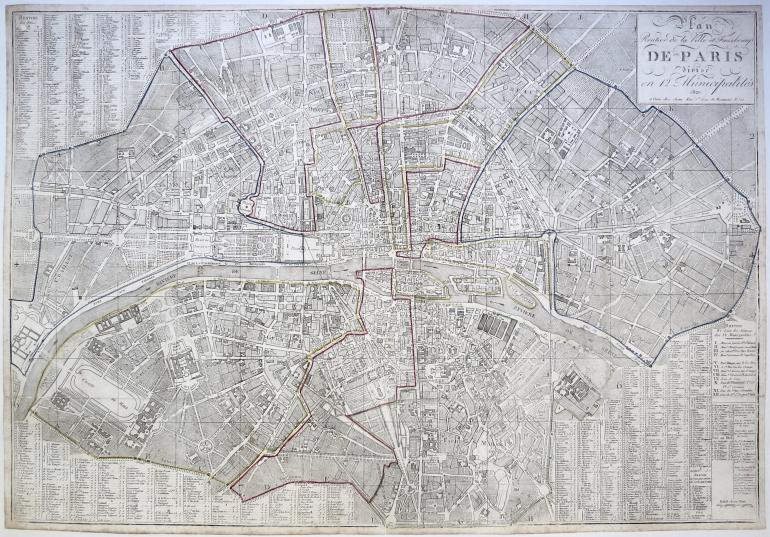
JEAN Pierre (publisher) (1754 - 1829)
No. 11347
Description
(1754 - 1829)
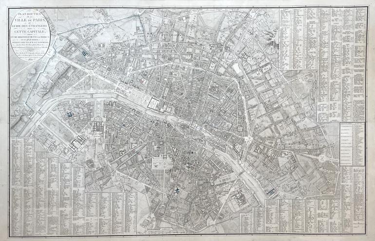
Le plan routier de la ville et des faubourgs de Paris, divisé en douze municipalités
1820
Etching with handcoloured lines
Technical specifications
Map published by Jean, Paris. With the streets and a two hundred height gauge.
Plate: 565 x 820 mm.
Condition: small margins, impression laid on strong paper, light-staining in the edges, small tears and paper's abrasions in the edges.
600 €