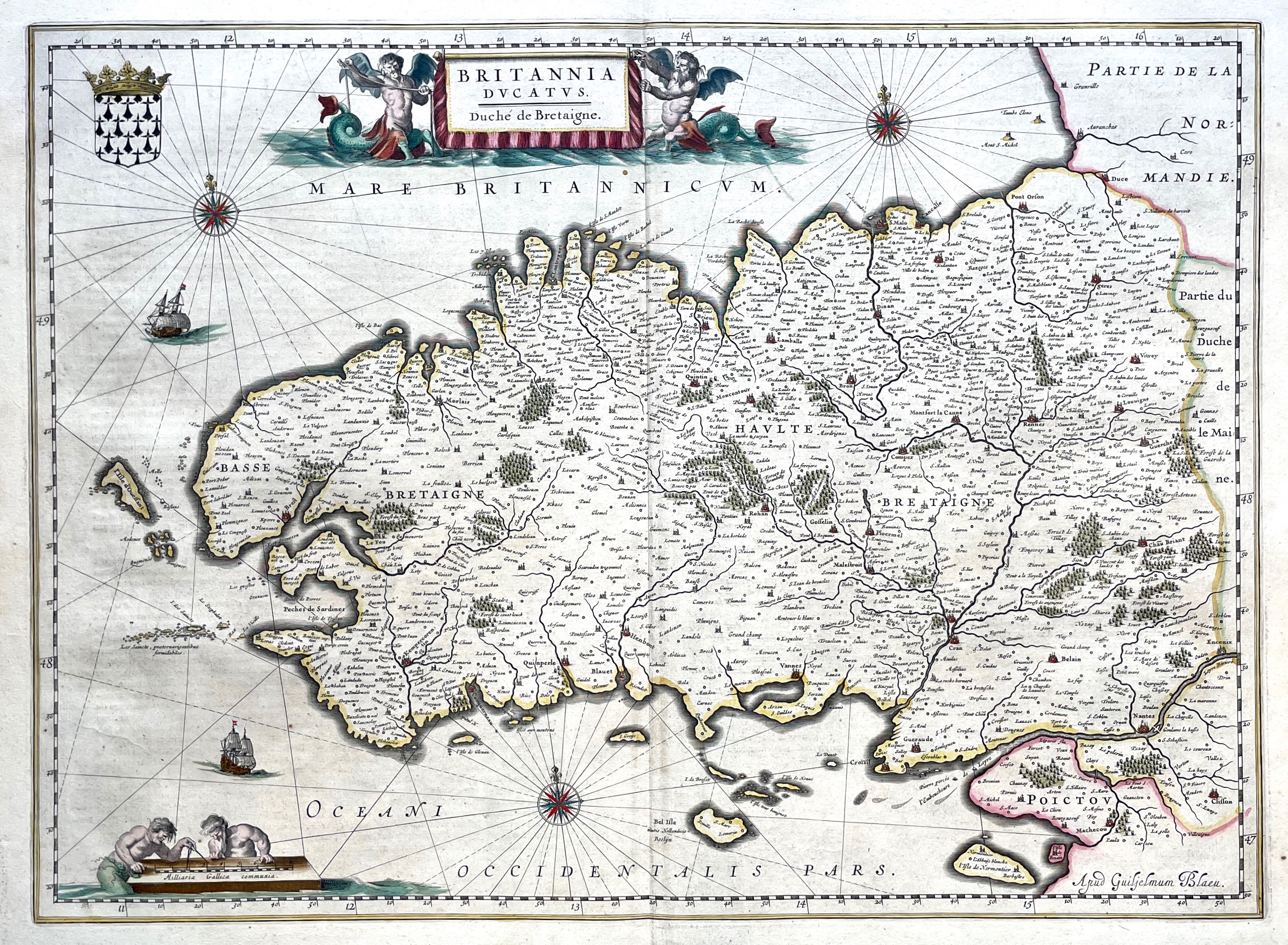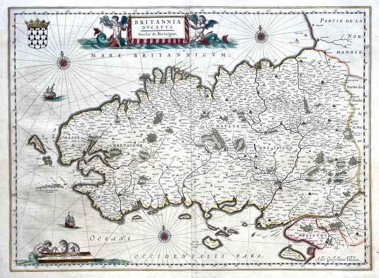
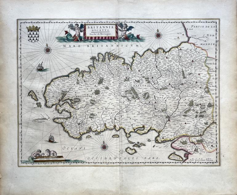
BLAEU Guillaume (cartographer) (1571 - 1638)
No. 20145
Description
(1571 - 1638)
Map of the Brittany duchy
Etching handcoloured
Technical specifications
1663
Fine impression on laid paper in its original coloring, plate from Guillaume Blaeu's book, Le Grand Atlas, Amsterdam, Blaeu, 1663.
Sheet: 508 x 617 mm
Plate: 378 x 521 mm
Condition: vertical fold in the center, very short tears along the edges.
550 €